
Karangasem topographic map
Interactive map
Click on the map to display elevation.
About this map
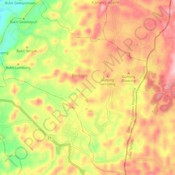
Name: Karangasem topographic map, elevation, terrain.
Location: Karangasem, Ponjong, Gunung Kidul Regency, Indonesia (-8.02654 110.72372 -7.98300 110.76131)
Average elevation: 393 m
Minimum elevation: 251 m
Maximum elevation: 493 m