
町田市 topographic map
Interactive map
Click on the map to display elevation.
About this map
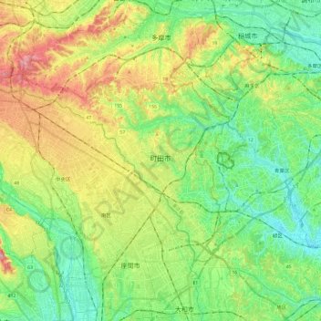
Name: 町田市 topographic map, elevation, terrain.
Location: 町田市, Tokyo, Kantō, Japon (35.50125 139.26882 35.62350 139.50759)
Average elevation: 81 m
Minimum elevation: 7 m
Maximum elevation: 215 m
Other topographic maps
Click on a map to view its topography, its elevation and its terrain.