Geolocate

Pindwara topographic map

Interactive map

Click on the map to display elevation.

About this map

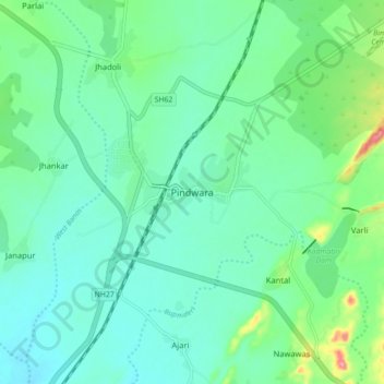
Name: Pindwara topographic map, elevation, terrain.

Location: Pindwara, Pindwara Tehsil, Sirohi District, Rajasthan, 307022, India (24.75260 73.00690 24.83260 73.08690)

Average elevation: 379 m

Minimum elevation: 353 m

Maximum elevation: 470 m

Pindwara is located at 24°47′40″N 73°03′18″E / 24.7945°N 73.055°E / 24.7945; 73.055. It has an average elevation of 372 m (1,220 ft).

Wikipedia (CC-BY-SA 3.0)

Other topographic maps

Click on a map to view its topography, its elevation and its terrain.

Kantal

India > Rajasthan > Pindwara Tehsil

Kantal, Pindwara Tehsil, Sirohi District, Rajasthan, 307022, India

Average elevation: 384 m