
Thank you for supporting this site ❤️
Make a donation
Make a donation
Puerto Gaitán topographic map
Click on the map to display elevation.
Thank you for supporting this site ❤️
Make a donation
Make a donation
About this map
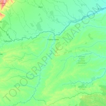
Name: Puerto Gaitán topographic map, elevation, terrain.
Location: Puerto Gaitán, Rio Meta, Meta, Colombia (3.27326 -72.40672 4.92514 -71.07741)
Average elevation: 189 m
Minimum elevation: 121 m
Maximum elevation: 778 m
Thank you for supporting this site ❤️
Make a donation
Make a donation
Other topographic maps
Click on a map to view its topography, its elevation and its terrain.