
Parc national de Masoala topographic map
Interactive map
Click on the map to display elevation.
About this map
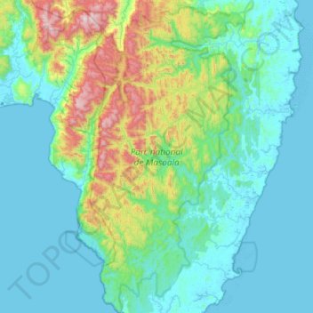
Name: Parc national de Masoala topographic map, elevation, terrain.
Average elevation: 213 m
Minimum elevation: -2 m
Maximum elevation: 1,286 m
Other topographic maps
Click on a map to view its topography, its elevation and its terrain.
Anjanaharibe-Sud
Anjanaharibe-Sud, Sava, Province d'Antsiranana, Madagaskar
Average elevation: 987 m