
Morse topographic map
Interactive map
Click on the map to display elevation.
About this map
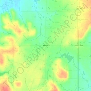
Name: Morse topographic map, elevation, terrain.
Location: Morse, Okfuskee County, Oklahoma, USA (35.51675 -96.30223 35.55675 -96.26223)
Average elevation: 245 m
Minimum elevation: 218 m
Maximum elevation: 275 m