
Thank you for supporting this site ❤️
Make a donation
Make a donation
Grantsburg topographic map
Click on the map to display elevation.
Thank you for supporting this site ❤️
Make a donation
Make a donation
About this map
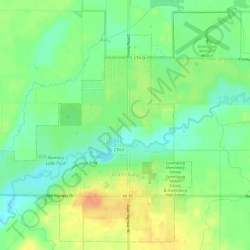
Name: Grantsburg topographic map, elevation, terrain.
Location: Grantsburg, Burnett County, Wisconsin, United States (45.76566 -92.71298 45.80249 -92.65662)
Average elevation: 283 m
Minimum elevation: 265 m
Maximum elevation: 307 m
Thank you for supporting this site ❤️
Make a donation
Make a donation
Other topographic maps
Click on a map to view its topography, its elevation and its terrain.
Danbury
United States > Wisconsin > Burnett County > Town of Swiss
Danbury is located at 46.006N. The longitude is -92.371W. It is in the Central Standard Time Zone. The elevation is 938 feet (286 m) above sea level.
Average elevation: 287 m