
Thank you for supporting this site ❤️
Make a donation
Make a donation
Waldheim topographic map
Click on the map to display elevation.
Thank you for supporting this site ❤️
Make a donation
Make a donation
About this map
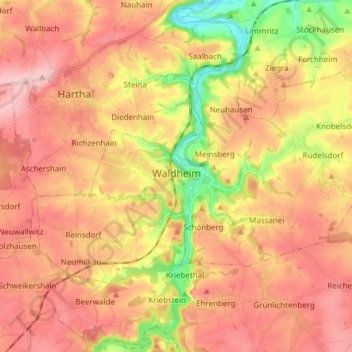
Name: Waldheim topographic map, elevation, terrain.
Location: Waldheim, Mittelsachsen, Saxony, 04736, Germany (51.04711 12.95564 51.10504 13.10762)
Average elevation: 261 m
Minimum elevation: 161 m
Maximum elevation: 328 m
Thank you for supporting this site ❤️
Make a donation
Make a donation
Other topographic maps
Click on a map to view its topography, its elevation and its terrain.