
Thank you for supporting this site ❤️
Make a donation
Make a donation
Parroquia Chirica topographic map
Click on the map to display elevation.
Thank you for supporting this site ❤️
Make a donation
Make a donation
About this map
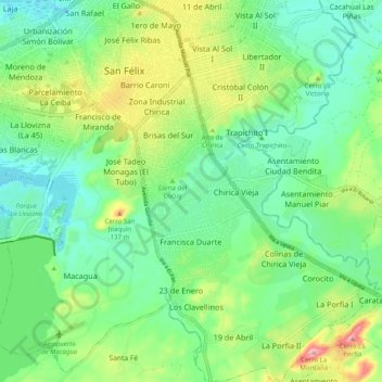
Name: Parroquia Chirica topographic map, elevation, terrain.
Location: Parroquia Chirica, Municipio Caroní, Estado Bolívar, Venezuela (8.26696 -62.65545 8.36562 -62.58486)
Average elevation: 60 m
Minimum elevation: 1 m
Maximum elevation: 190 m
Thank you for supporting this site ❤️
Make a donation
Make a donation
Other topographic maps
Click on a map to view its topography, its elevation and its terrain.