
Thank you for supporting this site ❤️
Make a donation
Make a donation
Sunlight topographic map
Click on the map to display elevation.
Thank you for supporting this site ❤️
Make a donation
Make a donation
About this map
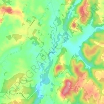
Name: Sunlight topographic map, elevation, terrain.
Location: Sunlight, Greenbrier County, West Virginia, United States (37.96706 -80.48147 38.00706 -80.44147)
Average elevation: 686 m
Minimum elevation: 638 m
Maximum elevation: 753 m
Thank you for supporting this site ❤️
Make a donation
Make a donation