
Thank you for supporting this site ❤️
Make a donation
Make a donation
Montgomery topographic map
Click on the map to display elevation.
Thank you for supporting this site ❤️
Make a donation
Make a donation
About this map
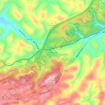
Name: Montgomery topographic map, elevation, terrain.
Location: Montgomery, Montgomery County, Virginia, United States (37.13652 -80.33894 37.17652 -80.29894)
Average elevation: 584 m
Minimum elevation: 475 m
Maximum elevation: 680 m
Thank you for supporting this site ❤️
Make a donation
Make a donation
Other topographic maps
Click on a map to view its topography, its elevation and its terrain.