
Thank you for supporting this site ❤️
Make a donation
Make a donation
Manaure topographic map
Click on the map to display elevation.
Thank you for supporting this site ❤️
Make a donation
Make a donation
About this map
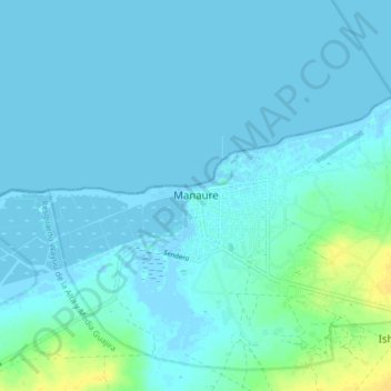
Name: Manaure topographic map, elevation, terrain.
Location: Manaure, La Guajira, Colombia (11.73711 -72.48694 11.81711 -72.40694)
Average elevation: 3 m
Minimum elevation: -6 m
Maximum elevation: 22 m
Thank you for supporting this site ❤️
Make a donation
Make a donation
Other topographic maps
Click on a map to view its topography, its elevation and its terrain.