Geolocate

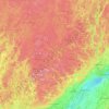
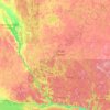
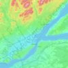
La Grande Rivière topographic map

Click on the map to display elevation.

About this map

Name: La Grande Rivière topographic map, elevation, terrain.

Location: La Grande Rivière, Quebec, Canada (53.21748 -73.46281 53.90080 -70.79041)

Average elevation: 489 m

Minimum elevation: 372 m

Maximum elevation: 730 m

Other topographic maps

Click on a map to view its topography, its elevation and its terrain.

Notre-Dame-des-Bois

Canada > Quebec > Le Granit

Average elevation: 593 m

Lac-Supérieur

Canada > Quebec > Les Laurentides

Average elevation: 458 m

Mount Royal

Canada > Quebec > Urban agglomeration of Montreal > Montreal

The hill is part of the Monteregian Hills situated between the Laurentians and the Appalachian Mountains. It gave its Latin name, Mons Regius, to the Monteregian chain. The hill consists of three peaks: Colline de la Croix (or Mont Royal proper) at 233 m (764 ft), Colline d'Outremont (or Mount Murray, in the…

Average elevation: 111 m
Quebec

Canada > Quebec > Urban agglomeration of Québec

Quebec City was built on the north bank of the Saint Lawrence River, where it narrows and meets the mouth of the Saint-Charles River. Old Quebec is located on top and at the foot of Cap-Diamant, which is on the eastern edge of a plateau called the promontory of Quebec (Quebec hill). Because of this topographic…

Average elevation: 117 m

Laval (administrative region)

Canada > Quebec

Average elevation: 42 m

Rivière-à-Pierre

Canada > Quebec > Portneuf (MRC)

Average elevation: 346 m

Rivière-Rouge

Canada > Quebec > Antoine-Labelle

Average elevation: 371 m

Lac-des-Écorces

Canada > Quebec > Antoine-Labelle

Average elevation: 277 m

Dégelis

Canada > Quebec > Témiscouata

Average elevation: 287 m

Hull

Canada > Quebec > Gatineau

Average elevation: 66 m

Montérégie

Canada > Quebec

Average elevation: 157 m

Lanaudière

Canada > Quebec

The region of Lanaudière is part of central Quebec and is located between the Saint Lawrence River and the Laurentian Mountains, between Mauricie and the Laurentides. Lanaudière attracts a good deal of interest from vacationers due to its unique character founded largely on the harmony between its culture…

Average elevation: 332 m

La Haute-Côte-Nord

Canada > Quebec

Average elevation: 348 m

Eastmain (Village)

Canada > Quebec > Jamésie

Average elevation: 81 m

Témiscamingue

Canada > Quebec

Average elevation: 318 m

Saint-Hyacinthe

Canada > Quebec > Les Maskoutains

Average elevation: 39 m

Côte-Nord

Canada > Quebec

Average elevation: 327 m

Sainte-Adèle

Canada > Quebec > Les Pays-d'en-Haut

Average elevation: 336 m

Sept-Îles

Canada > Quebec > Sept-Rivières

Average elevation: 189 m

Quebec

Canada > Quebec > Urban agglomeration of Québec

Quebec City was built on the north bank of the Saint Lawrence River, where it narrows and meets the mouth of the Saint-Charles River. Old Quebec is located on top and at the foot of Cap-Diamant, which is on the eastern edge of a plateau called the promontory of Quebec (Quebec hill). Because of this topographic…

Average elevation: 117 m

Bécancour

Canada > Quebec > Bécancour (MRC)

Average elevation: 39 m

Lac-Jérôme

Canada > Quebec > Minganie

Average elevation: 471 m

Saint-Philémon

Canada > Quebec > Bellechasse

Average elevation: 522 m

Mékinac

Canada > Quebec

Average elevation: 344 m

Lévis

Canada > Quebec

Average elevation: 96 m

Gaspésie

Canada > Quebec > La Haute-Gaspésie > Mont-Albert

Average elevation: 459 m

Gaspé Peninsula

Canada > Quebec

Average elevation: 190 m

Vallée-Jonction

Canada > Quebec > La Nouvelle-Beauce

Average elevation: 243 m

Le Rocher-Percé

Canada > Quebec

Average elevation: 147 m

Wakefield

Canada > Quebec > Les Collines-de-l'Outaouais

Average elevation: 151 m

Saint-Rémi-de-Tingwick

Canada > Quebec > Arthabaska

Average elevation: 287 m

Saint-Elzéar

Canada > Quebec > Bonaventure (MRC)

Average elevation: 218 m

Rivière de la Petite Nation

Canada > Quebec > Papineau

Average elevation: 274 m

Grande-Vallée

Canada > Quebec > La Côte-de-Gaspé

Average elevation: 282 m

Réservoir-Dozois

Canada > Quebec > La Vallée-de-l'Or

Average elevation: 373 m

Wiyâshâkimî Lake

Canada > Quebec > Kativik

Average elevation: 269 m

Rivière Péribonka

Canada > Quebec

Average elevation: 487 m

Trois-Rivières

Canada > Quebec

Average elevation: 39 m

Lac-à-la-Truite

Canada > Quebec > Les Appalaches > Adstock

Average elevation: 426 m

La Côte-de-Gaspé

Canada > Quebec

Average elevation: 148 m

La Haute-Gaspésie

Canada > Quebec

Average elevation: 247 m

La Matapédia

Canada > Quebec

Average elevation: 299 m

Abitibi-Témiscamingue

Canada > Quebec

Average elevation: 333 m

Rivière Saint-Maurice

Canada > Quebec

Average elevation: 391 m

Île aux Coudres

Canada > Quebec > Charlevoix > Saint-Louis

Average elevation: 14 m

Mont-Tremblant

Canada > Quebec > Les Laurentides

The city is dominated by Mont Tremblant with an altitude of 968m which is one of the highest peaks in southern Quebec.

Average elevation: 358 m

Sherbrooke

Canada > Quebec

Average elevation: 232 m

Verchères

Canada > Quebec > Marguerite-D'Youville

Average elevation: 19 m

Venise-en-Québec

Canada > Quebec > Le Haut-Richelieu

Average elevation: 31 m

Tee Lake

Canada > Quebec > Témiscamingue

Average elevation: 280 m

Île Papineau

Canada > Quebec > Antoine-Labelle > Mont-Laurier

Average elevation: 282 m

Saint-Éleuthère

Canada > Quebec > Témiscouata

Average elevation: 296 m

Estérel

Canada > Quebec > Les Pays-d'en-Haut

Average elevation: 370 m

Saint-André-d'Argenteuil

Canada > Quebec > Argenteuil

Average elevation: 48 m

Déléage

Canada > Quebec > La Vallée-de-la-Gatineau

Average elevation: 195 m

Château-Richer

Canada > Quebec > La Côte-de-Beaupré

Average elevation: 278 m

Chénéville

Canada > Quebec > Papineau

Average elevation: 249 m

Chaudière-Appalaches

Canada > Quebec

Average elevation: 323 m

Rivière Nottaway

Canada > Quebec

Average elevation: 219 m

Rivière Koksoak

Canada > Quebec > Kativik

Average elevation: 139 m

Rivière-Nouvelle

Canada > Quebec > Avignon

Average elevation: 379 m

Saint-Césaire

Canada > Quebec > Rouville

Average elevation: 53 m

Percé

Canada > Quebec > Le Rocher-Percé

Average elevation: 44 m

Châteauguay

Canada > Quebec > Roussillon

Average elevation: 32 m

Gatineau

Canada > Quebec

Gatineau is located in southwestern Quebec, on the northern bank of the Gatineau River. It is situated at an elevation of around 50 m (164.042 ft) The Gatineau Hills are the foothills of the Laurentian Mountains and located in the region. It is also the location of the second largest urban park in the world.…

Average elevation: 127 m

Deux-Montagnes (MRC)

Canada > Quebec

Average elevation: 49 m

Rouyn-Noranda

Canada > Quebec

Average elevation: 307 m

Pointe Décarie

Canada > Quebec > Les Laurentides > La Minerve

Average elevation: 328 m

Saint-Léandre

Canada > Quebec > La Matanie

Average elevation: 190 m