
Malmöhus slott topographic map
Interactive map
Click on the map to display elevation.
About this map
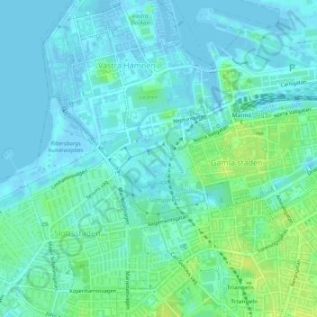
Name: Malmöhus slott topographic map, elevation, terrain.
Average elevation: 5 m
Minimum elevation: -13 m
Maximum elevation: 15 m
Other topographic maps
Click on a map to view its topography, its elevation and its terrain.
Malmö
Suède > Comté de Scanie > Malmö
Malmö, Malmö kommun, Comté de Scanie, Götaland, 211 34, Suède
Average elevation: 15 m
Niagara
Suède > Comté de Scanie > Malmö
Niagara, Västra Hamnen, Norr, Malmö, Malmö kommun, Comté de Scanie, Götaland, Suède
Average elevation: 4 m