
Riale topographic map
Click on the map to display elevation.
About this map
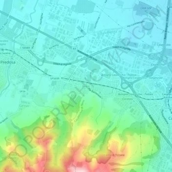
Name: Riale topographic map, elevation, terrain.
Average elevation: 102 m
Minimum elevation: 43 m
Maximum elevation: 307 m
Other topographic maps
Click on a map to view its topography, its elevation and its terrain.
Fiume Reno
Italia > Emilia-Romagna > Bologna > Casalecchio di Reno > Croce di Casalecchio
Average elevation: 129 m