
Thank you for supporting this site ❤️
Make a donation
Make a donation
Marshfield topographic map
Click on the map to display elevation.
Thank you for supporting this site ❤️
Make a donation
Make a donation
About this map
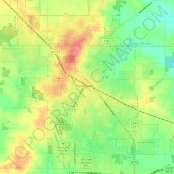
Name: Marshfield topographic map, elevation, terrain.
Location: Marshfield, Wood County, Wisconsin, United States (44.62428 -90.22345 44.70705 -90.12421)
Average elevation: 382 m
Minimum elevation: 349 m
Maximum elevation: 422 m
Thank you for supporting this site ❤️
Make a donation
Make a donation
Other topographic maps
Click on a map to view its topography, its elevation and its terrain.