
Thank you for supporting this site ❤️
Make a donation
Make a donation
Roan Mountain topographic map
Click on the map to display elevation.
Thank you for supporting this site ❤️
Make a donation
Make a donation
Roan Mountain
Roan Mountain is located in northeast Tennessee at 36°11′39″N 82°4′6″W / 36.19417°N 82.06833°W / 36.19417; -82.06833 (36.194219, -82.068417). According to the United States Census Bureau, the CDP has a total area of 6.6 square miles (17.2 km2), all land. The elevation of Roan Mountain near the center of the CDP is 2,550 feet (780 m).
Thank you for supporting this site ❤️
Make a donation
Make a donation
About this map
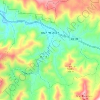
Name: Roan Mountain topographic map, elevation, terrain.
Average elevation: 926 m
Minimum elevation: 760 m
Maximum elevation: 1,210 m
Thank you for supporting this site ❤️
Make a donation
Make a donation