
Уня topographic map
Interactive map
Click on the map to display elevation.
About this map
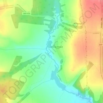
Name: Уня topographic map, elevation, terrain.
Average elevation: 148 m
Minimum elevation: 115 m
Maximum elevation: 185 m
Other topographic maps
Click on a map to view its topography, its elevation and its terrain.
Уня
Russie > Oudmourtie > Увинский район > Нылга
Уня, Нылга, Увинский район, Oudmourtie, District fédéral de la Volga, 427248, Russie
Average elevation: 120 m