
Thank you for supporting this site ❤️
Make a donation
Make a donation
Long Island topographic map
Click on the map to display elevation.
Thank you for supporting this site ❤️
Make a donation
Make a donation
About this map
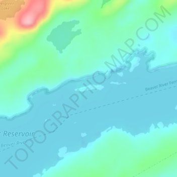
Name: Long Island topographic map, elevation, terrain.
Location: Long Island, Town of Webb, Herkimer County, New York, USA (43.90526 -75.00150 43.90666 -74.99499)
Average elevation: 532 m
Minimum elevation: 506 m
Maximum elevation: 653 m
Thank you for supporting this site ❤️
Make a donation
Make a donation
Other topographic maps
Click on a map to view its topography, its elevation and its terrain.
Thank you for supporting this site ❤️
Make a donation
Make a donation
Thank you for supporting this site ❤️
Make a donation
Make a donation
Thank you for supporting this site ❤️
Make a donation
Make a donation
Thank you for supporting this site ❤️
Make a donation
Make a donation
Thank you for supporting this site ❤️
Make a donation
Make a donation