
Thank you for supporting this site ❤️
Make a donation
Make a donation
Songwe topographic map
Click on the map to display elevation.
Thank you for supporting this site ❤️
Make a donation
Make a donation
About this map
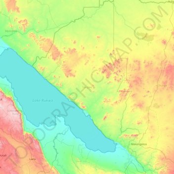
Name: Songwe topographic map, elevation, terrain.
Location: Songwe, Southern Highlands Zone, Tanzania (-8.72632 32.04292 -6.92769 33.23235)
Average elevation: 1,186 m
Minimum elevation: 790 m
Maximum elevation: 2,399 m
Thank you for supporting this site ❤️
Make a donation
Make a donation