
Thank you for supporting this site ❤️
Make a donation
Make a donation
La Rue de la Croix topographic map
Click on the map to display elevation.
Thank you for supporting this site ❤️
Make a donation
Make a donation
About this map
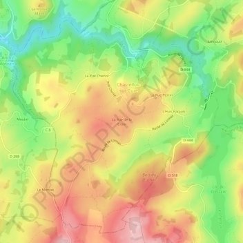
Name: La Rue de la Croix topographic map, elevation, terrain.
Average elevation: 316 m
Minimum elevation: 213 m
Maximum elevation: 415 m
Thank you for supporting this site ❤️
Make a donation
Make a donation
Other topographic maps
Click on a map to view its topography, its elevation and its terrain.
Château de Chastellux
France > Bourgogne-Franche-Comté > Yonne > Chastellux-sur-Cure
Average elevation: 305 m