
Thank you for supporting this site ❤️
Make a donation
Make a donation
Torres topographic map
Click on the map to display elevation.
Thank you for supporting this site ❤️
Make a donation
Make a donation
Torres
Torres is part of the Metropolitan Mesoregion of Porto Alegre and the Osório Microregion. It is located at a latitude of 29º20'34" south and a longitude of 49º43'39" west, at an altitude of 16 meters. It has an area of 161.624 km². It is 197 km from Porto Alegre and 280 km from Florianópolis. Its borders are the municipality of Passo de Torres (SC) to the north, Arroio do Sal to the south, Mampituba, Dom Pedro de Alcântara, and Morrinhos do Sul to the west, and the Atlantic Ocean to the east.
Thank you for supporting this site ❤️
Make a donation
Make a donation
About this map
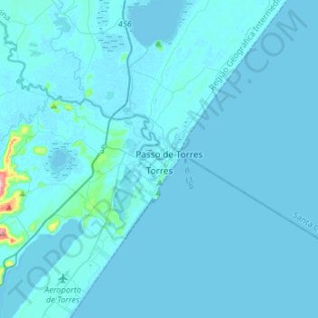
Name: Torres topographic map, elevation, terrain.
Average elevation: 6 m
Minimum elevation: -4 m
Maximum elevation: 234 m
Thank you for supporting this site ❤️
Make a donation
Make a donation