
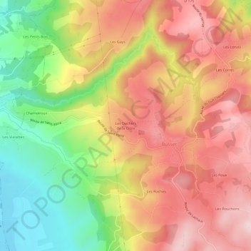
Les Dachers de la Croix topographic map
Interactive map
Click on the map to display elevation.
About this map
Name: Les Dachers de la Croix topographic map, elevation, terrain.
Average elevation: 424 m
Minimum elevation: 268 m
Maximum elevation: 550 m
Other topographic maps
Click on a map to view its topography, its elevation and its terrain.
Les Corres
France > Auvergne-Rhône-Alpes > Allier > Busset
Les Corres, Busset, Vichy, Allier, Auvergne-Rhône-Alpes, France métropolitaine, 03270, France
Average elevation: 451 m
Les Roches
France > Auvergne-Rhône-Alpes > Allier > Busset
Les Roches, Busset, Vichy, Allier, Auvergne-Rhône-Alpes, France métropolitaine, 03270, France
Average elevation: 440 m