
Villars-sous-Mont topographic map
Interactive map
Click on the map to display elevation.
About this map
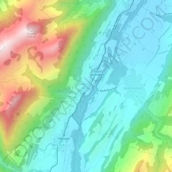
Name: Villars-sous-Mont topographic map, elevation, terrain.
Average elevation: 989 m
Minimum elevation: 709 m
Maximum elevation: 1,662 m
Other topographic maps
Click on a map to view its topography, its elevation and its terrain.
Enney
Suisse > Fribourg > District de la Gruyère > Bas-Intyamon
Enney, Bas-Intyamon, District de la Gruyère, Fribourg, 1667, Suisse
Average elevation: 878 m