
Thank you for supporting this site ❤️
Make a donation
Make a donation
Al Mushallahah topographic map
Click on the map to display elevation.
Thank you for supporting this site ❤️
Make a donation
Make a donation
About this map
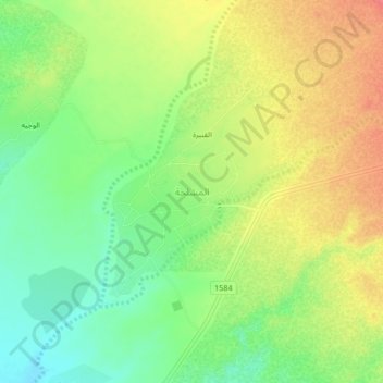
Name: Al Mushallahah topographic map, elevation, terrain.
Location: Al Mushallahah, Jazan Province, Saudi Arabia (17.32283 42.74429 17.36283 42.78429)
Average elevation: 140 m
Minimum elevation: 109 m
Maximum elevation: 173 m
Thank you for supporting this site ❤️
Make a donation
Make a donation
Other topographic maps
Click on a map to view its topography, its elevation and its terrain.
Thank you for supporting this site ❤️
Make a donation
Make a donation
Thank you for supporting this site ❤️
Make a donation
Make a donation
Thank you for supporting this site ❤️
Make a donation
Make a donation
Thank you for supporting this site ❤️
Make a donation
Make a donation