
Thank you for supporting this site ❤️
Make a donation
Make a donation
Rudelzhausen topographic map
Click on the map to display elevation.
Thank you for supporting this site ❤️
Make a donation
Make a donation
About this map
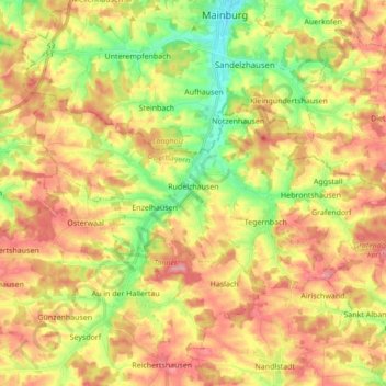
Name: Rudelzhausen topographic map, elevation, terrain.
Location: Rudelzhausen, Landkreis Freising, Bavaria, 84104, Germany (48.55951 11.69661 48.61632 11.86843)
Average elevation: 476 m
Minimum elevation: 419 m
Maximum elevation: 526 m
Thank you for supporting this site ❤️
Make a donation
Make a donation
Other topographic maps
Click on a map to view its topography, its elevation and its terrain.