
Thank you for supporting this site ❤️
Make a donation
Make a donation
Ridgedale topographic map
Click on the map to display elevation.
Thank you for supporting this site ❤️
Make a donation
Make a donation
About this map
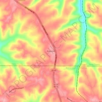
Name: Ridgedale topographic map, elevation, terrain.
Location: Ridgedale, Taney County, Missouri, United States (36.48395 -93.24379 36.52395 -93.20379)
Average elevation: 387 m
Minimum elevation: 299 m
Maximum elevation: 429 m
Thank you for supporting this site ❤️
Make a donation
Make a donation