
Rakamcherla topographic map
Click on the map to display elevation.
About this map
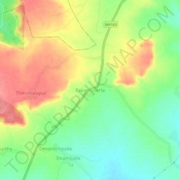
Name: Rakamcherla topographic map, elevation, terrain.
Location: Rakamcherla, Pudur mandal, Vikarabad, Telangana, 501501, India (17.21923 77.93617 17.25923 77.97617)
Average elevation: 682 m
Minimum elevation: 644 m
Maximum elevation: 723 m