
Thank you for supporting this site ❤️
Make a donation
Make a donation
Union City topographic map
Click on the map to display elevation.
Thank you for supporting this site ❤️
Make a donation
Make a donation
About this map
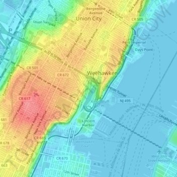
Name: Union City topographic map, elevation, terrain.
Location: Union City, Hudson County, New Jersey, 07087, United States (40.75061 -74.04586 40.78287 -74.01480)
Average elevation: 26 m
Minimum elevation: -4 m
Maximum elevation: 80 m
Thank you for supporting this site ❤️
Make a donation
Make a donation
Other topographic maps
Click on a map to view its topography, its elevation and its terrain.