
El Cabo Occidental topographic map
Interactive map
Click on the map to display elevation.
About this map
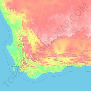
Name: El Cabo Occidental topographic map, elevation, terrain.
Location: El Cabo Occidental, Sudáfrica (-35.03376 17.56879 -30.43026 24.22241)
Average elevation: 581 m
Minimum elevation: 0 m
Maximum elevation: 2,197 m
Other topographic maps
Click on a map to view its topography, its elevation and its terrain.
Mitchells Plain
Sudáfrica > El Cabo Occidental > Mitchells Plain
Mitchells Plain, City of Cape Town, El Cabo Occidental, 7785, Sudáfrica
Average elevation: 24 m
Cape Town Ward 67
Sudáfrica > El Cabo Occidental > Ciudad del Cabo
Cape Town Ward 67, Ciudad del Cabo, City of Cape Town, El Cabo Occidental, Sudáfrica
Average elevation: 11 m