
Erlen topographic map
Interactive map
Click on the map to display elevation.
About this map
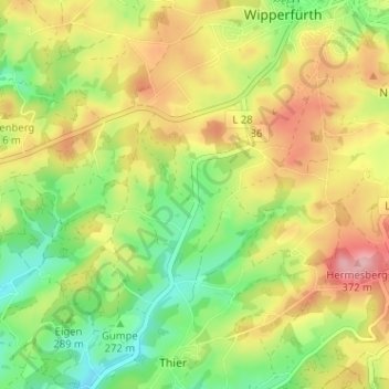
Name: Erlen topographic map, elevation, terrain.
Average elevation: 299 m
Minimum elevation: 228 m
Maximum elevation: 381 m
Other topographic maps
Click on a map to view its topography, its elevation and its terrain.
Erlen
Allemagne > Rhénanie-du-Nord-Westphalie > Erlen
Erlen, Oberbergischer Kreis, Rhénanie-du-Nord-Westphalie, 51689, Allemagne
Average elevation: 300 m