
Albany topographic map
Click on the map to display elevation.
About this map
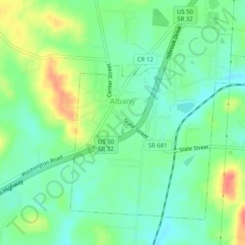
Name: Albany topographic map, elevation, terrain.
Location: Albany, Athens County, Ohio, United States (39.21450 -82.20982 39.23585 -82.17956)
Average elevation: 235 m
Minimum elevation: 215 m
Maximum elevation: 271 m
Other topographic maps
Click on a map to view its topography, its elevation and its terrain.