
Hochseiler topographic map
Interactive map
Click on the map to display elevation.
About this map
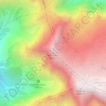
Name: Hochseiler topographic map, elevation, terrain.
Average elevation: 2,194 m
Minimum elevation: 1,336 m
Maximum elevation: 2,836 m
Other topographic maps
Click on a map to view its topography, its elevation and its terrain.
Steinernes Meer
Österreich > Salzburg > Maria Alm am Steinernen Meer
Steinernes Meer, Maria Alm am Steinernen Meer, Zell am See, Salzburg, 5761, Österreich
Average elevation: 1,503 m