
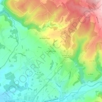
Le Petit Fahys topographic map
Interactive map
Click on the map to display elevation.
About this map
Name: Le Petit Fahys topographic map, elevation, terrain.
Average elevation: 367 m
Minimum elevation: 287 m
Maximum elevation: 488 m
Other topographic maps
Click on a map to view its topography, its elevation and its terrain.
Blanzey
France > Bourgogne-Franche-Comté > Haute-Saône > Fougerolles-Saint-Valbert
Blanzey, Fougerolles, Fougerolles-Saint-Valbert, Lure, Haute-Saône, Bourgogne-Franche-Comté, France métropolitaine, 70220, France
Average elevation: 389 m
Fougerolles
France > Bourgogne-Franche-Comté > Haute-Saône > Fougerolles-Saint-Valbert
Fougerolles, Fougerolles-Saint-Valbert, Lure, Haute-Saône, Bourgogne-Franche-Comté, France métropolitaine, 70220, France
Average elevation: 399 m