
Borough of Swale topographic map
Interactive map
Click on the map to display elevation.
About this map
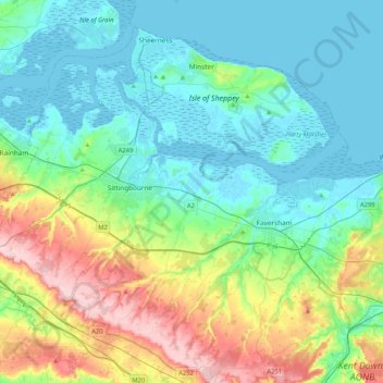
Name: Borough of Swale topographic map, elevation, terrain.
Location: Borough of Swale, Kent, England, United Kingdom (51.22435 0.60095 51.44914 1.01696)
Average elevation: 50 m
Minimum elevation: -3 m
Maximum elevation: 200 m
Other topographic maps
Click on a map to view its topography, its elevation and its terrain.
Littlestone on Sea
United Kingdom > England > Kent > Folkestone and Hythe District > New Romney
Average elevation: 1 m