
Brook topographic map
Click on the map to display elevation.
About this map
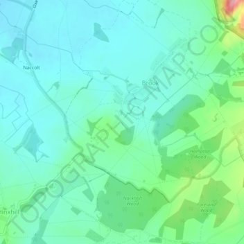
Name: Brook topographic map, elevation, terrain.
Location: Brook, Ashford, Kent, England, United Kingdom (51.14220 0.93531 51.16959 0.96650)
Average elevation: 57 m
Minimum elevation: 32 m
Maximum elevation: 146 m
Other topographic maps
Click on a map to view its topography, its elevation and its terrain.
Wye National Nature Reserve
United Kingdom > England > Kent > Ashford > Brook
Average elevation: 123 m