
Rammstein topographic map
Interactive map
Click on the map to display elevation.
About this map
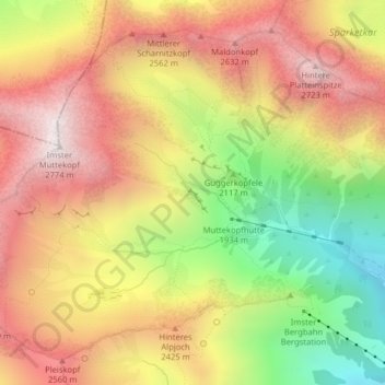
Name: Rammstein topographic map, elevation, terrain.
Location: Rammstein, Stadt Imst, Bezirk Imst, Tirol, 6460, Österreich (47.26414 10.66520 47.26431 10.66574)
Average elevation: 2,248 m
Minimum elevation: 1,634 m
Maximum elevation: 2,752 m