
Thank you for supporting this site ❤️
Make a donation
Make a donation
Lousada topographic map
Click on the map to display elevation.
Thank you for supporting this site ❤️
Make a donation
Make a donation
About this map
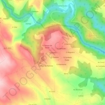
Name: Lousada topographic map, elevation, terrain.
Location: Lousada, Recelle, Portomarín, Lugo, Galicia, 27187, España (42.83292 -7.67435 42.87292 -7.63435)
Average elevation: 474 m
Minimum elevation: 350 m
Maximum elevation: 584 m
Thank you for supporting this site ❤️
Make a donation
Make a donation
Other topographic maps
Click on a map to view its topography, its elevation and its terrain.