
Bác Ái topographic map
Interactive map
Click on the map to display elevation.
About this map
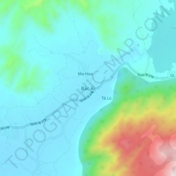
Name: Bác Ái topographic map, elevation, terrain.
Location: Bác Ái, Huyện Bác Ái, Ninh Thuận, Vietnam (11.80105 108.86441 11.88105 108.94441)
Average elevation: 322 m
Minimum elevation: 114 m
Maximum elevation: 1,257 m