
Granstein topographic map
Interactive map
Click on the map to display elevation.
About this map
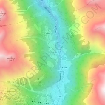
Name: Granstein topographic map, elevation, terrain.
Location: Granstein, Sölden, Bezirk Imst, 6450, Oostenrijk (46.97223 10.98741 47.01223 11.02741)
Average elevation: 1,923 m
Minimum elevation: 1,257 m
Maximum elevation: 2,800 m
Other topographic maps
Click on a map to view its topography, its elevation and its terrain.
Hochgurgl
Oostenrijk > Bezirk Imst > Sölden
Hochgurgl, Sölden, Bezirk Imst, 6456, Oostenrijk
Average elevation: 2,277 m