
Thank you for supporting this site ❤️
Make a donation
Make a donation
Villa Ottavia topographic map
Click on the map to display elevation.
Thank you for supporting this site ❤️
Make a donation
Make a donation
About this map
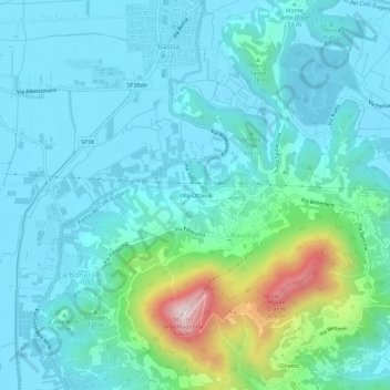
Name: Villa Ottavia topographic map, elevation, terrain.
Location: Villa Ottavia, Rovolon, Padova, Veneto, 35030, Italia (45.35034 11.63651 45.39034 11.67651)
Average elevation: 97 m
Minimum elevation: 9 m
Maximum elevation: 521 m
Thank you for supporting this site ❤️
Make a donation
Make a donation