
Make a donation
Gulf Hills topographic map
Click on the map to display elevation.
Make a donation
Gulf Hills
The terrain in the Bayou Porteaux region is relatively high considering its proximity to the Gulf of Mexico. Elevations range from sea level to 25 feet (7.6 m) above sea level. The area of interest lies south of the Big Ridge escarpment, on the western terminus of an east-west striking coastal ridge, which is sub-parallel to the Big Ridge. Here small bayous and streams have dissected the topography with steep ravines to create a "hilly" terrain. Reconnaissance, surface and geologic investigations indicate that alluvial-fluvial deposits of the Late Pleistocene Prairie Formation are exposed in the higher areas of the Bayou Porteaux-Gulf Hills section.
Make a donation
About this map
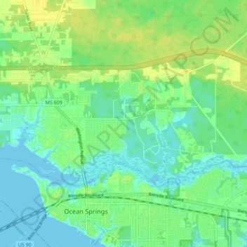
Name: Gulf Hills topographic map, elevation, terrain.
Location: Gulf Hills, Jackson County, Mississippi, United States (30.41860 -88.85797 30.45630 -88.77216)
Average elevation: 8 m
Minimum elevation: -2 m
Maximum elevation: 18 m
Make a donation
Other topographic maps
Click on a map to view its topography, its elevation and its terrain.