
Thank you for supporting this site ❤️
Make a donation
Make a donation
West Looe topographic map
Click on the map to display elevation.
Thank you for supporting this site ❤️
Make a donation
Make a donation
About this map
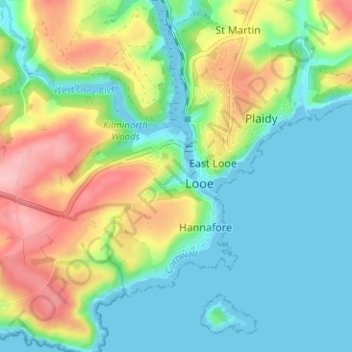
Name: West Looe topographic map, elevation, terrain.
Location: West Looe, Looe, Cornwall, England, PL13 2BQ, United Kingdom (50.33311 -4.47830 50.37311 -4.43830)
Average elevation: 48 m
Minimum elevation: -1 m
Maximum elevation: 143 m
Thank you for supporting this site ❤️
Make a donation
Make a donation