
Thank you for supporting this site ❤️
Make a donation
Make a donation
Martinsville topographic map
Click on the map to display elevation.
Thank you for supporting this site ❤️
Make a donation
Make a donation
About this map
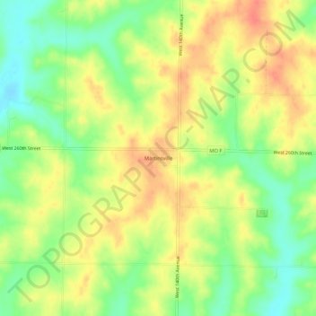
Name: Martinsville topographic map, elevation, terrain.
Location: Martinsville, Harrison County, Missouri, United States (40.31861 -94.18162 40.35861 -94.14162)
Average elevation: 322 m
Minimum elevation: 295 m
Maximum elevation: 345 m
Thank you for supporting this site ❤️
Make a donation
Make a donation
Other topographic maps
Click on a map to view its topography, its elevation and its terrain.