
Make a donation
Four Corners topographic map
Click on the map to display elevation.
Make a donation
About this map
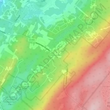
Name: Four Corners topographic map, elevation, terrain.
Average elevation: 255 m
Minimum elevation: 149 m
Maximum elevation: 382 m
Make a donation
Other topographic maps
Click on a map to view its topography, its elevation and its terrain.
High Point State Park
United States > New Jersey > Sussex County > Montague Township
High Point State Park is a state park straddling the border of Wantage Township and Montague Township in Sussex County, within the Skylands Region of northwestern New Jersey, United States, near the border with New York State and Pennsylvania. The park covers 15,413 acres (62.37 km2). Part of the Kittatinny…
Average elevation: 255 m
High Point State Park
United States > New Jersey > Sussex County > Montague Township
High Point State Park is a state park straddling the border of Wantage Township and Montague Township in Sussex County, within the Skylands Region of northwestern New Jersey, United States, near the border with New York State and Pennsylvania. The park covers 15,413 acres (62.37 km2). Part of the Kittatinny…
Average elevation: 257 m