
Thank you for supporting this site ❤️
Make a donation
Make a donation
Sabrina Lake topographic map
Click on the map to display elevation.
Thank you for supporting this site ❤️
Make a donation
Make a donation
About this map
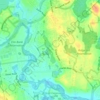
Name: Sabrina Lake topographic map, elevation, terrain.
Average elevation: 45 m
Minimum elevation: 29 m
Maximum elevation: 68 m
Thank you for supporting this site ❤️
Make a donation
Make a donation
Other topographic maps
Click on a map to view its topography, its elevation and its terrain.
Charles River Village
United States > Massachusetts > Norfolk County > Needham
Average elevation: 49 m