
Thank you for supporting this site ❤️
Make a donation
Make a donation
Llandre topographic map
Click on the map to display elevation.
Thank you for supporting this site ❤️
Make a donation
Make a donation
About this map
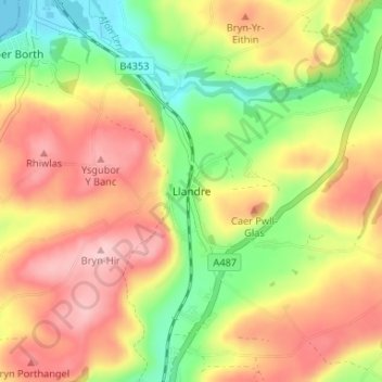
Name: Llandre topographic map, elevation, terrain.
Location: Llandre, Ceredigion, Wales, SY24 5DD, United Kingdom (52.44284 -4.04388 52.48284 -4.00388)
Average elevation: 91 m
Minimum elevation: 0 m
Maximum elevation: 175 m
Thank you for supporting this site ❤️
Make a donation
Make a donation