
Thank you for supporting this site ❤️
Make a donation
Make a donation
Mecatlán topographic map
Click on the map to display elevation.
Thank you for supporting this site ❤️
Make a donation
Make a donation
About this map
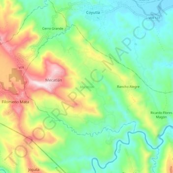
Name: Mecatlán topographic map, elevation, terrain.
Location: Mecatlán, Veracruz, Mexico (20.17393 -97.69889 20.24074 -97.59993)
Average elevation: 386 m
Minimum elevation: 112 m
Maximum elevation: 916 m
Thank you for supporting this site ❤️
Make a donation
Make a donation
Other topographic maps
Click on a map to view its topography, its elevation and its terrain.