
Thank you for supporting this site ❤️
Make a donation
Make a donation
Ustaoset topographic map
Click on the map to display elevation.
Thank you for supporting this site ❤️
Make a donation
Make a donation
About this map
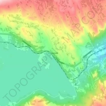
Name: Ustaoset topographic map, elevation, terrain.
Location: Ustaoset, Hol, Buskerud, 3593, Norway (60.47825 8.02426 60.51825 8.06426)
Average elevation: 1,036 m
Minimum elevation: 947 m
Maximum elevation: 1,183 m
Thank you for supporting this site ❤️
Make a donation
Make a donation
Other topographic maps
Click on a map to view its topography, its elevation and its terrain.