
Thank you for supporting this site ❤️
Make a donation
Make a donation
Sucia Island topographic map
Click on the map to display elevation.
Thank you for supporting this site ❤️
Make a donation
Make a donation
About this map
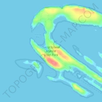
Name: Sucia Island topographic map, elevation, terrain.
Location: Sucia Island, San Juan County, Washington, United States (48.74610 -122.92004 48.77045 -122.88412)
Average elevation: 7 m
Minimum elevation: -1 m
Maximum elevation: 69 m
Thank you for supporting this site ❤️
Make a donation
Make a donation
Other topographic maps
Click on a map to view its topography, its elevation and its terrain.